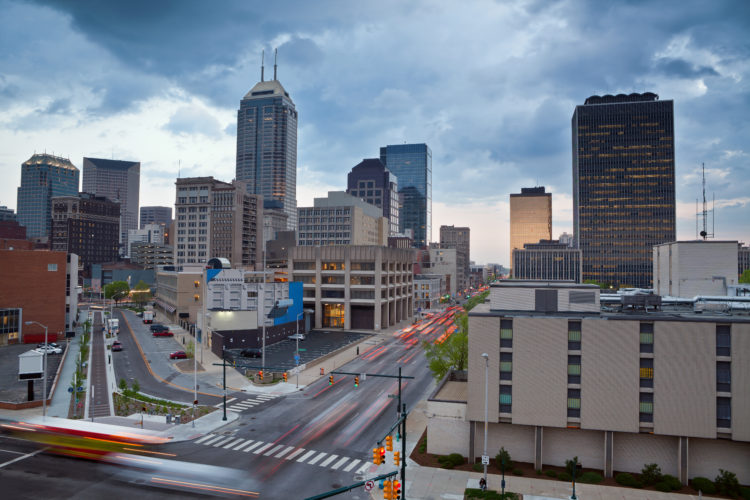
If you live, work, or commute anywhere near the IndyGo Red Line route, you’re probably breathing a sigh of relief as the construction has finally subsided.
And now that the construction is over, dedicated lane is completed, and bus stations are built, what now? With service officially beginning on Sunday, September 1, here’s everything you need to know to start taking advantage of this fabulous addition to our great city.
BONUS: Did you know that riding the Red Line is totally free for the first month?! We promise it’s not to good to be true. Don’t miss your chance to try it out for no cost at all this September.
Everything You Need to Know About the IndyGo Red Line
Where?
The electric rapid Red Line spans just over 13 miles from Broad Ripple to the University of Indianapolis, with its northern most stop at 66th and College. You’ll find stops along the way in some of Indianapolis’ busiest areas, including downtown and Fountain Square. Download the full route map here.
Along the route, you will find two different kinds of stations among the 28 total: curbside and center. At curbside stations, you’ll be able to board the bus right on the side of the road in the direction you’re going. At center stations, use the crosswalk to cross the street safely, climb the gradual ramp that leads to the platform, and stand on the side of the station in the direction you’re going. Each bus station will feature:
- Ramps to lead you to the bus-height boarding platform (built according to the American Disabilities Act)
- Wind screens and awnings for protection from weather
- Digital marquees to notify you when the next bus is arriving
- Ticket vending machines that accept cash or card
- Security cameras and emergency phones
- Plenty of lights
When?
A “rapid” transit line, the Red Line will consistently stop at each station every 10-20 minutes for 20 hours a day, seven days a week. The general schedule will run as follows:
Monday – Friday
5:00am – 9:00pm every 10 minutes
9:00pm – 1:00am every 15 minutes
Saturday
6:00am – 1:00am every 15 minutes
Sunday
7:00am – 8:00pm every 15 minutes
8:00pm – 10:00pm every 20 minutes
For up-to-date, specific times, I recommend using the public transit feature on Google Maps, whether on the mobile app or via a quick google.com/maps search before you leave home.
How?
First the first month of Red Line service – the month of September – you won’t have to worry about purchasing tickets because rides all month are free for all! Starting October 1, you’ll need to purchase bus passes in order to ride. You’ve got a few options for how you can do that.
Find the full list of trip fares here. Please note that each one-way fare is good for two hours, so any transfers within that two-hour block won’t cost extra.
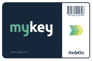
MyKey Card
For a $2 fee, you can purchase your very own reusable MyKey card a few different ways:
- At Red Line station ticket-vending kiosks that accept cash or card
- In person at the Julia M. Carson Transit Center, 201 E. Washington Street
- Over the phone: 317.635.3344
You’ll be able to reload this card at said kiosks, in person at the Julia M. Carson Transit Center, or through the MyKey mobile app (which has not been released yet, so don’t be surprised if you don’t see it in your smart phone’s app store). You’ll scan your card as you board the bus, so make sure it’s loaded with sufficient funds before you board!
MyKey App
As mentioned, this app is not yet ready, but will be the most convenient way for many to purchase passes. By October 1, you’ll be able to download this app, connect your debit or credit card to it, and load money onto your account directly from your mobile device. You can do this without purchasing a physical MyKey card. You’ll then scan your personal QR code within the app every time you board the bus.
On Board
You can always give exact change to the bus driver as you board the bus for One Trip or One Day passes only. You’ll be given a two-hour transfer ticket, so don’t lose this during your trip so that any transfers within your two-hour block are covered.
Read about more ticket purchasing options here.
Why?
Increased efficient and affordable public transportation goes hand-in-hand with a growing city like Indianapolis. As more companies begin to open offices here and the population grows, the responsible thing to do is to provide people (and the environment) with fuel efficient and convenient ways to get around town. The Red Line is a huge step in that direction. According to IndyGo’s website, “The Red Line corridor is the densest population and employment corridor within Marion County, and the pedestrian-friendly environment it will create along the route will extend the rapid transit benefits to communities and neighborhoods all along its path.”
As with anything, this change will take some getting used to. And if the Red Line is not near your home or place of work, don’t worry! IndyGo has numerous other bus lines around the city, with plans to add more buses into rotation and to build more electric rapid transit lines just like the Red Line. Read all about why and how the Red Line was constructed here.
What’s next?!
So glad you asked. Plans for the Blue Line and Purple Line are currently in the works.
Blue Line: “The Blue Line will provide rapid transit along Washington Street between Cumberland and the Airport, replacing and improving the existing Route 8 local service, providing fast, frequent and reliable transit service for its entirety of 24 miles.”
Purple Line: “Rapid transit between Indy and Lawrence! To better connect you to your city and your city to you, IndyGo’s Purple Line will provide frequent transit service between Downtown Indianapolis and Lawrence.”
Stay up to date on all current and future projects at indygo.net/projects.
Have questions about tickets, routes, trip advice, etc? Call IndyGo’s call center at (317) 635-3344, visit the Transit Center at 201 E. Washington St, or head to IndyGo’s website.


